
Geo Spatial Data Solutions Development
Enterprise GIS systems integration, design, development & implementation
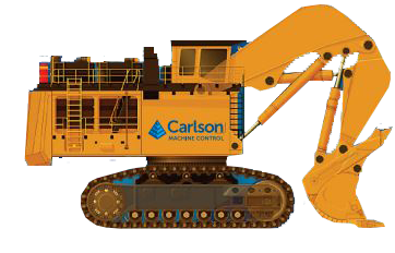
Machine Control Systems Installation
Machine Control System from CARLSON Company for Landfill Compactors, Dozers and Graders

Drone ِAerial Mapping
DRONE FOR HIGH-ACCURACY AERIAL MAPPING & SURVEYS
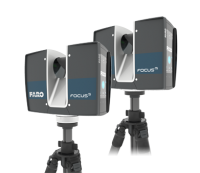
3D Laser Scanning Measurement and Modelling
3D Reality Capture & Accurate As-Built Measurements

Land Survey and Topographic Survey
Full range of Surveying Services (Topographic Survey, Land Survey, Stockpile Surveying & GIS Mapping)
about us
GEOGRAPHIC TECHNOLOGIES TRADING
GTT act as a gateway to the gulf region, helping clients' broker ideas and skills from different global sources in America, Europe and emerging markets and bringing clients' needs together with global solutions.
Our Vision
We commit ourselves for helping our customers in various fields, improving the speed of their services, taking advantage of GIS...
read moreOur Mission
GTT objective is to provide continuity, profit and growth through the highest operational ethics and standards; and to build and...
read moreOur Startegy
We are committed to helping clients across diverse Markets improve their speed to market, optimize resources and reduce costs, thereby...
read moreCEO's Message
We believe that the key to any success is source selection, and choosing partners correctly. By using the resources of...
read moreGTT Services
GEOGRAPHIC TECHNOLOGIES TRADING
GTT has extensive experience in the delivery of Geo-spatial services. Our global partners and experienced engineers will accomplish your project goals using industry standard methods to provide effective and efficient services for the delivery of your project.
Machine Control Systems Installation
Installation of Machine Control System from CARLSON Company for Landfill Compactors, Dozers and Graders
read moreDrone Mapping
Our certified pilots are able to perform fast aerial surveys across wide or hard-to-reach areas and producing reliable maps with …
read moreGeo Spatial Data Solutions Development
Throughout our successful Geo-Spatial projects we completed with our global partners in America, Europe and …
read moreLand Survey and Topographic Survey
Ground and topographic survey works are carried out to measure the features and levels of the surface of the project …
read more3D Laser Scanning Measurement and Modelling
Three-dimensional laser scanning technology using a mobile or fixed laser scanner is one of the latest …
read moreGTT Projects
GEOGRAPHIC TECHNOLOGIES TRADING
With Passion & Experience
Drone Mapping Survey
Geo-Spatial Data Solutions Development
Land Survey and Topographic Survey
Laser Scanning
Mapping & Spatial Data Enhancement
3D Drone Mapping for Holy Makkah City Boundary
The project included the implementation of the following work tasks: The Project total area (62.25 …
details
importing an updated satellite images for 4 city’s
The project aims to supply and process satellite imagery for Jeddah, Madinah, Taif and Tabuk
details
Development, operation and maintenance for CORS stations and VRS system in Makkah.
The project includes the following tasks: Operation & development of the current CORS stations Updating …
details
Saudi Post spatial data enhancement project
The project includes the following tasks: Developing a (QA / QC) methodology. Processing and correction …
details
Developing of e-Dig streets works permit system 3rd version project
The e-digging licenses project aims to make the digital transformation of the work of the …
details Support and maintenance of GIS department in Saudi Post project
The project aims to supply, install and maintain GIS programs and provide technical support to …
detailsDevelop a planning support system (PSS) at the MDA project
PSS represents a geospatially-enabled technology platform developed to support planning activities carried out by planners …
details Developing of e-Dig streets works permit system 2nd version project
The project aims to make the digital transformation of the street works procuders in the …
details Spatial data conversion to the new Saudi datum & establishing 10 CORS stations with VRS network system project
The project aims to caculate the geodetic coordinate conversion values between the old coordinate system …
details
Developing enterprise GIS system with centralized Geo-database for Madinah Municipality
The project includes a number of main tasks as follows: Developing a centralized GIS system …
details Establish CORS stations and developing VRS system project
The project aims to calculate the geodetic coordinate conversion values between the old coordinate system …
details
Developing GIS analysis tools for IKEA to support marketing plans
The project aims to build a geo-database based on a correct and valid basemap, through …
details Developing of e-Dig streets works permit system 1st version project
The project aims to develop the basic spatial data for the street works system and …
details
Supply, installment & maintenance of GIS programs & training project
The project aims to supply, install and maintain GIS programs and train users for Ma’aden
details Updating GIS Database for Madinah Municipality & Developing Municipal Services Applications in GIS (2nd phase project)
The project includes a number of main tasks as follows: Supplying new ortho-rectified satellite imagery …
details
Supply, installment & maintenance of GIS programs
The project aims to supply, install and maintain GIS programs and provide technical support to …
details
Developing GIS system for Madinah central area
Digitizing all paper maps of the central area of Madinah and transform it to GIS environment Build …
details
Establish Sewage Network GIS Database 2nd phase project
The project includes a number of main tasks as follows: Digitizing Madinah’s sewage network paper …
details
Developing of municipal investments GIS application
Building an updated database for all investment sites and projecting them on the city base …
details Establish water network GIS database 1st phase project
The project Includes a number of main tasks as follows: Digitizing Madinah’s water network paper maps Build …
details
Supplying satellite imageries to update Jazan municipality base-map project
The project aims to supply updated ortho-rectified satellite imageries to update the base-map for all …
details Establish the Municipality GIS system 1st phase project
The project includes a number of main tasks as follows: Building a single basemap for Madinah, …
details
Establish land information documentation system project
The project aims to build a system for documenting MOMRA land transaction data in the …
details Updating sectoral activities maps of kingdom coastal areas & building GIS database – 3rd phase project
The project aims to collect and update the status of all the activities for all …
details Updating cadastral maps of kingdom coastal areas & building GIS database – 2nd phase project
The project aims to collect and update the property data for all of the Kingdom’s …
details Updating land use maps of kingdom coastal areas & building GIS database – 1st phase project
The project aims to collect and update the land use status for all of the …
detailsSupplying satellite imageries to update Taif municipality’s basemap project
The project aims to supply updated ortho-rectified satellite imageries to update the base-map for Taif …
details Madinah Municipality pilot GIS project project
The project aims to show the Municipality how to implement GIS technology over a limited …
detailsAl Madinah Spatial Data Infrastucture (SDI) at Madinah Development Authority
The Madinah Spatial Data Infrastructure (MSDI) is a corner stone project, not only for the …
details
Dhaiyat Sumou plan – Establishing Reference point’s – Parcel Boundary corners stakeout project
Register the main deed in Makkah Municipality system Create seven bench marks on the plan …
details Spatial enhancement of Makkah parcels data project
The project aims to update the parcels data in Makkah according to the international GIS …
detailsTopography Laser Scan for Waad Al-Shamaal Industrial City
The project aims to do an accurate laser scanning for the topography of the total …
details
3D Laser scanning and modeling for the holy black stone in Kaaba
3D Laser scanning and modeling for the holy black stone in Kaaba
details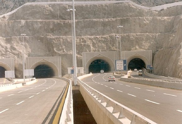
3D laser scanning and modeling for Makkah tunnels
The project aims to produce an accurate laser scan measurements of the current status of …
details3D Laser scanning and modeling for the Holy Mosque in Makkah
The project aims to make an accurate AS-built drawings using laser scanning for the Holy …
details
Building digital basemap for Panda stores locations in KSA project
The project aims to build a geo-database for all Panda commercial sites in the Kingdom …
detailsGTT Statistics
GEOGRAPHIC TECHNOLOGIES TRADING
Projects Completed
32
Project under Contruction
3
Projects under Study
5


GTT Partners
GEOGRAPHIC TECHNOLOGIES TRADING
This is what we’ve been working on

GTT prizes
GEOGRAPHIC TECHNOLOGIES TRADING
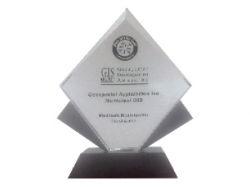
Geospatial DEVELOPMENT Awards
"Geospatial DEVELOPMENT Awards"
“Geospatial DEVELOPMENT Awards” in Geospatial Application for Municipal GIS from GIS DEVELOPMENT in the Middle East.
Phones
+966 55 304 8855
+966 50 995 1522
+966 55 099 9551
Email : info@gtt.com.sa
© 2020 DESIGN AND DEVOLPED BY KIAN
© 2020 all right reserved to GEOGRAPHIC TECHNOLOGIES TRADING